
Geolocation
The Geolocation module determines the user's current location through browser or device permissions. It is used to verify the user's geographical position as part of identity validation or compliance workflows.

Where it fits in the flow
Geolocation usually appears before ID and Selfie Capture.
After the user’s location is confirmed, the flow continues to biometric or document verification steps depending on the configured process.
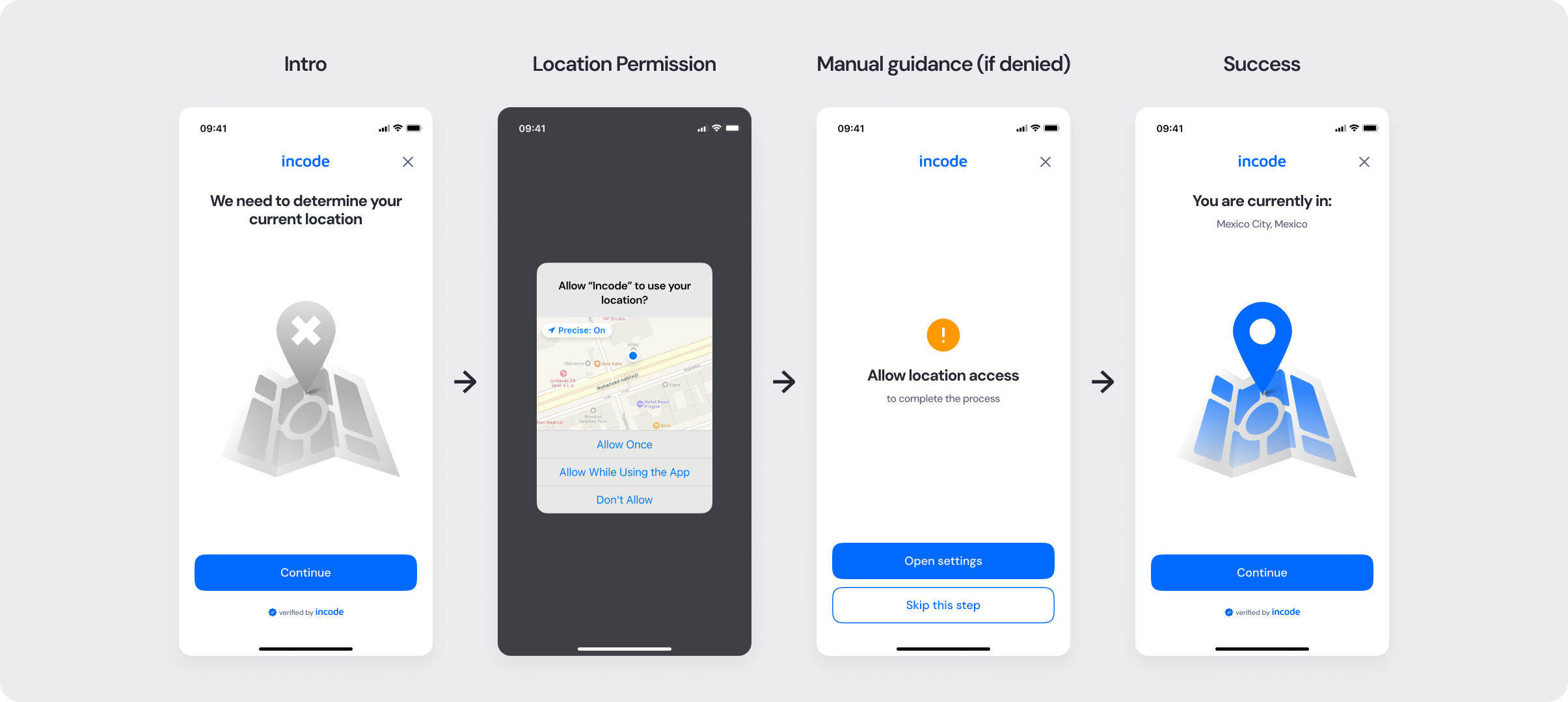
User Flow
The Geolocation experience guides the user from permission to confirmation. After granting access, the system detects the user’s current location and displays a confirmation screen with the detected city or region.
If detection fails or permission is denied, fallback paths guide the user to adjust their settings or skip the step (if option to skip is enabled via configuration settings). Once access is restored, the user can retry detection or continue to the next module.
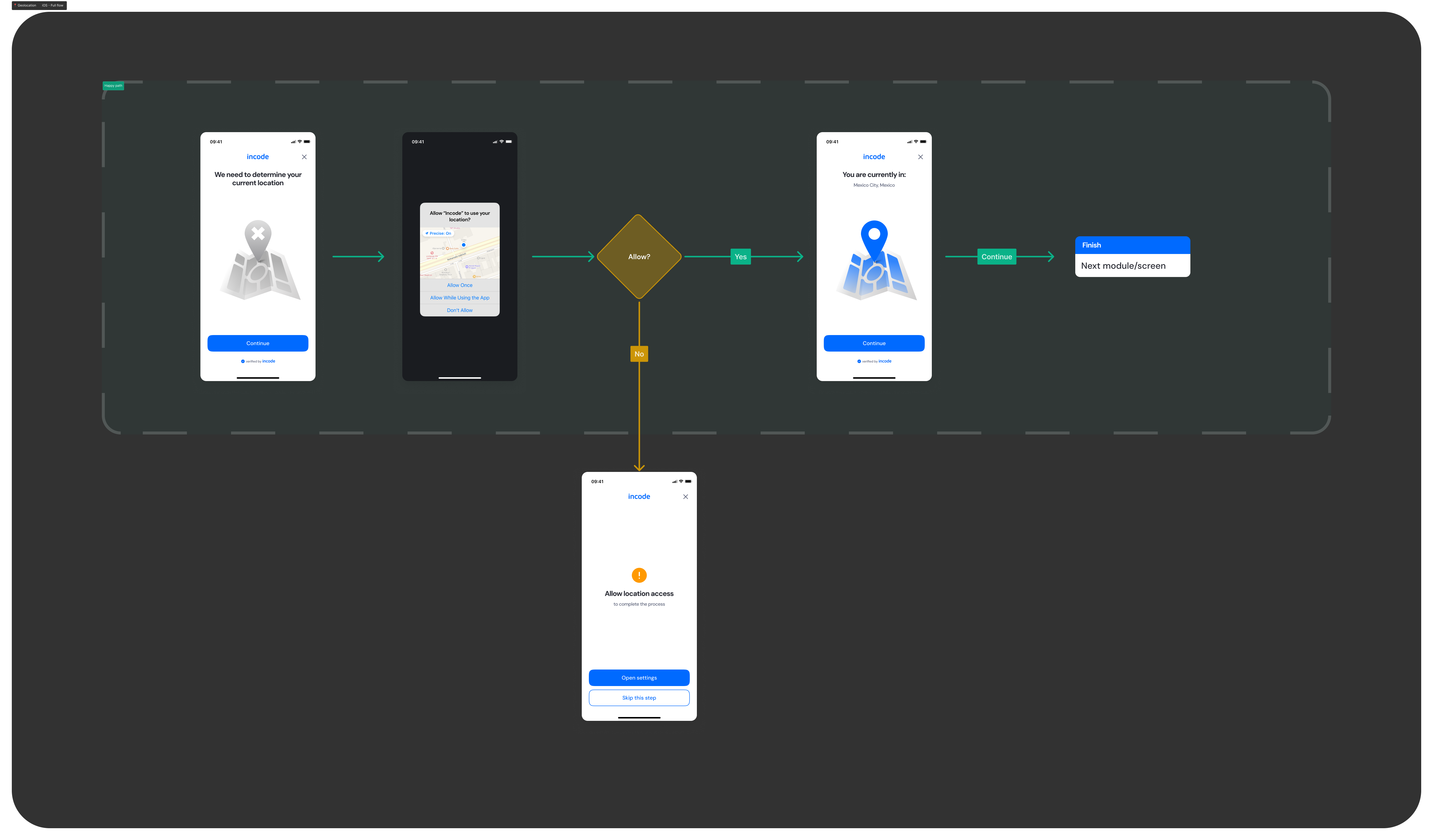
Full Flow Map
This diagram presents the full sequence of screens involved in the Geolocation module, from initial screen and location permission handling to successful location detection, fallback paths for denied permissions, and final confirmation.
It visually represents both the ideal and alternative user journeys, helping teams understand all possible user interactions and system states within the module.
Happy Path (Light & Dark)
The ideal user journey when the geolocation is detected successfully with no interruptions.
The happy path represents the smoothest version of the experience, where the user grants location access, the system accurately detects their current position, and the flow proceeds automatically without requiring manual retries or permission troubleshooting.
Both light and dark mode previews are included so design, product, and engineering teams can validate visual consistency and accessibility across themes.
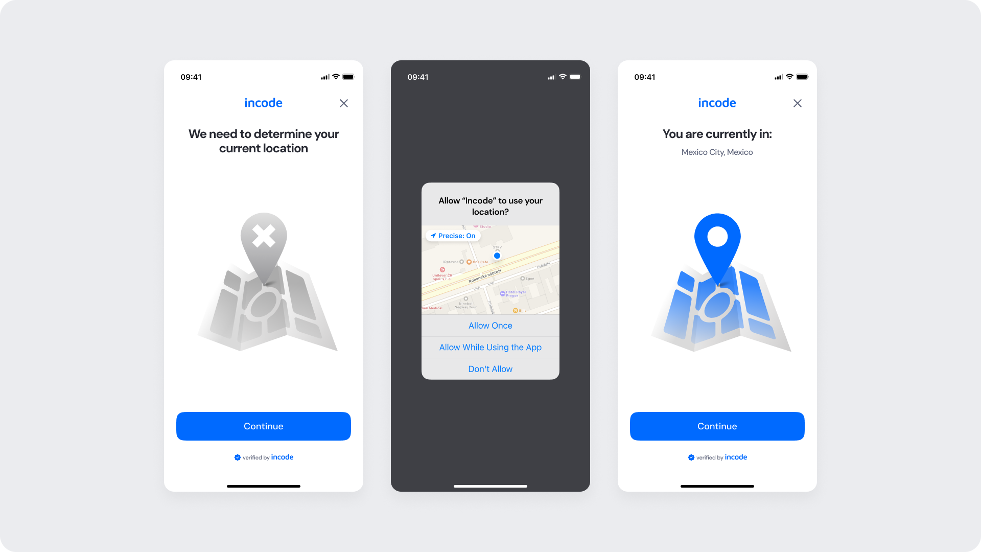
Light mode
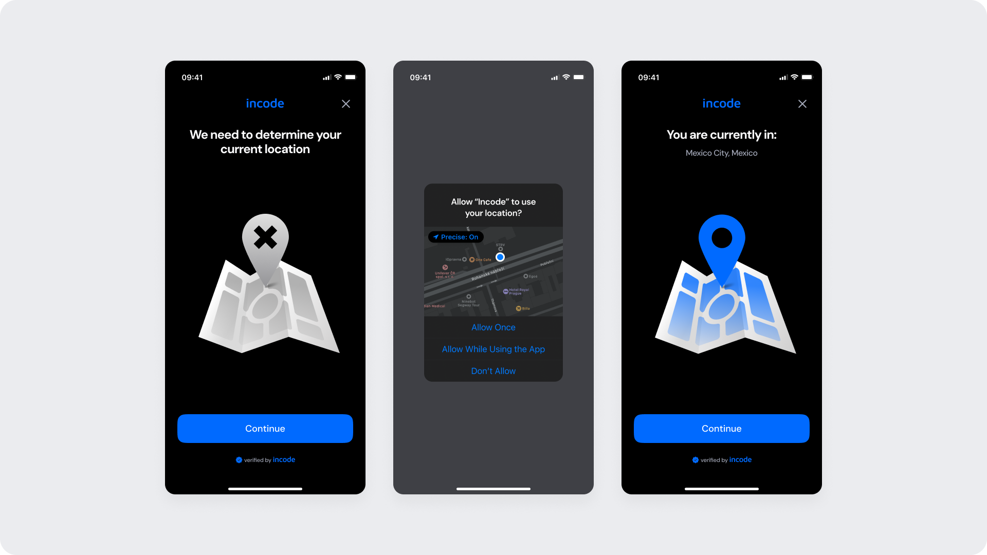
Dark mode
Best Practices
Recommended guidelines for designing and implementing the Geolocation experience.
✅ Do
- Explain why location data is requested — transparency builds trust.
- Offer a visible “Skip this step” option if location isn’t mandatory.
- Localize all geographic messages and region names.
❌ Don’t
- Don’t block progress indefinitely if the user denies permission.
- Avoid long delays.
Updated 3 months ago